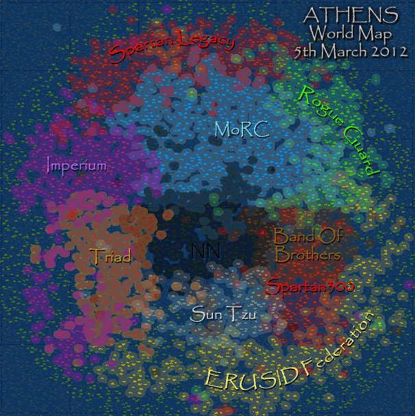
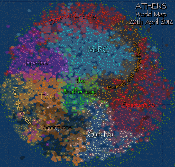
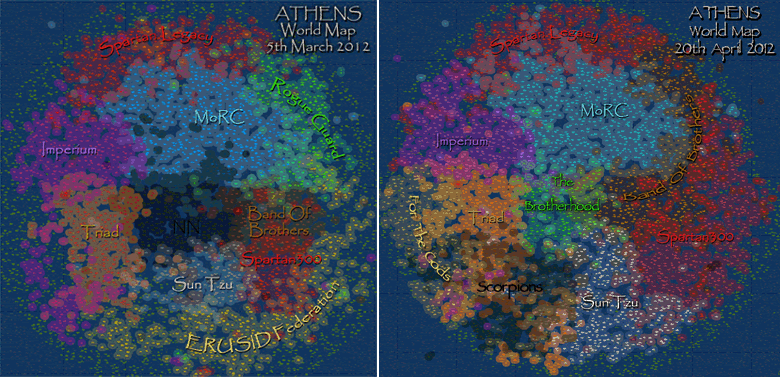
Hi, this map isn't auto-updating, but it does show islands controlled, overlapping territories, and optimally positioned Alliance names which gives an alternative easier to understand view of the World.
Each Alliances islands were extracted using the 'Select Color Range' command in Photoshop, which were then pasted back with c. 60% transparency, and 'outer-glow' added to give a control zone around each island. The partial transparency gives you the different colors where the control zones overlap.